Mostrar el registro sencillo del ítem
Determination of agro-environmental zones in Spain and sensitivity to global climatic change
| dc.contributor.author | Guzmán Díaz, María Gema | |
| dc.contributor.author | Vanwalleghem, Tom | |
| dc.contributor.author | Vanderlinden, Karl | |
| dc.contributor.author | Laguna Luna, Ana María | |
| dc.contributor.author | Giráldez Cervera, Juan Vicente | |
| dc.date.accessioned | 2017-11-28T10:03:48Z | |
| dc.date.available | 2017-11-28T10:03:48Z | |
| dc.date.issued | 2017 | |
| dc.identifier.uri | http://hdl.handle.net/10396/15535 | |
| dc.description | Póster presentado en la Conferencia EGU 2013, 07-12 Abril 2013, Viena, Austria | es_ES |
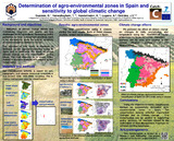
| dc.description.abstract | Soil has a key role in the regulation of carbon, water and nutrient cycles. Traditionally, agricultural soil management was oriented towards optimizing productivity. Nowadays, mitigation of climate change effects and maintaining long-term soil quality are evenly important. Developing policy guidelines for best management practices need to be site-specific, given the large spatial variability of environmental conditions within the EU. Therefore, it is necessary to classify the different farming zones that are susceptible to soil degradation. Especially in Mediterranean areas, this variability and its susceptibility to degradation is higher than in other areas of the EU. The objective of this study is therefore to delineate current agro-environmental zones in Spain and to determine the effect of global climate change on this classification in the future. The final objective is to assist policy makers in scenario analysis with respect to soil conservation. Our classification scheme is based on soil, topography and climate (seasonal temperature and rainfall) variables. We calculated slope and elevation based on a SRTM-derived DEM, soil texture was extracted from the European Soil Database and seasonal mean, minimum and maximum precipitation and temperature data were gridded from publically available weather station data (Aemet). Global change scenarios are average downscaled ensemble predictions for the emission scenarios A2 and B2. The k-means method was used for classification of the 10 km x 10 km gridded variables. Using the before-mentioned input variables, the optimal number of agro-environmental zones we obtained is 8. The classification corresponds well with the observed distribution of farming typologies in Spain. The advantage of this method is that it is a simple, objective method which uses only readily available, public data. As such, its extrapolation to other countries of the EU is straightforward. Finally, it presents a tool for policy makers to assess the impact of global change on farming systems and to plan soil conservation measures. | es_ES |
| dc.format.mimetype | application/pdf | es_ES |
| dc.language.iso | eng | es_ES |
| dc.rights | https://creativecommons.org/licenses/by-nc-nd/4.0/ | es_ES |
| dc.source | Conferencia EGU 2013, 07-12 Abril 2013, Viena, Austria | es_ES |
| dc.subject | Climate change | es_ES |
| dc.subject | Environmental conditions | es_ES |
| dc.subject | Degradation | es_ES |
| dc.subject | Soil conservation | es_ES |
| dc.subject | Soils | es_ES |
| dc.subject | Mediterranean areas | es_ES |
| dc.subject | Spain | es_ES |
| dc.title | Determination of agro-environmental zones in Spain and sensitivity to global climatic change | es_ES |
| dc.type | info:eu-repo/semantics/conferenceObject | es_ES |
| dc.relation.publisherversion | http://www.catch-c.eu | es_ES |
| dc.relation.projectID | info:eu-repo/grantAgreement/EC/FP7/89782 (Catch-C) | es_ES |
| dc.rights.accessRights | info:eu-repo/semantics/openAccess | es_ES |